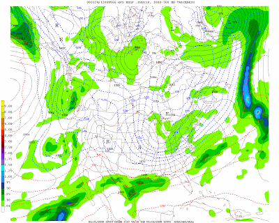
Well, while we are not getting those massive storms that cripple the entire region snowfall for most of Sussex, Warren, Western Morris, and Western Passaic counties are right where it should be for this time of the year if not surplus. We actually range in Sussex county from 21.50"-30.75" for the season. Season average is usually between 50"-70" depending on elevation which means we are right where we should be for being a 1/3 through winter. I have two interesting systems coming up which really get me exicted and I'll explain why.
First storm for Tuesday into Tuesday night is another cold front coming down out of the artic and it seems as if a storm will intensify as it hits the coast. Areas in northwest should remain all snow but the city seems to be a mix of precip with little if any accumulation. It depends when and where it intensifies off the coast and who knows, maybe the city can get a few inches. We just have to wait and see. Here are my guesses:

Storm #2 is what I am interested in. It doesn't look impressive because it isn't. It's coming in with and artic blast of air in an already artic air mass. If we get 1/10 -2/10 inch of precip (liquid) with snow ratios 30:1 then that's a good 3-6 inches of very fluffy dry snow. I will post a snowmap on Wednesday to make sure this system will even make it over the mountains. Check it out:


No comments:
Post a Comment