Wednesday, December 28, 2011

Long Range Outlook

Will it ever get cold?????

I want to start off with the 50 mb stratospheric temperature anomalies. Watch the loop below as the first "decent" stratospheric warming event of the season is taking place. This is in relation to pressure patterns over the arctic which most of us know as the Arctic Oscillation. What does this all even mean? Warming north of 50 degrees in the stratosphere is a clearly visible way to identify a negative Arctic Oscillation (AO) and that translates into cold and snow, and we will test that theory. I've actually done some extensive research on the AO which I presented at the National Weather Association in Birmingham Alabama back in October and this is just another typical event. The loop below will self update everyday so keep coming back to the blog to check on it's progress.
The above event should translate in an all out arctic air mass invasion for the eastern half of North America and I'm talking days where the high temperature struggles to break 15 degrees over the NW corner and Eastern areas will have a hard time breaking 20, even into NYC. Now let's just see if the models agree with me.

Very latest GFS:

The map above is for January 3rd and the cold outbreak should last at least several days, and that means several days of continuous snowmaking which means resorts in the region will begin to open terrain daily as ideal snowmaking conditions will persist for a minimum of 100 straight hours. So yes, the AO goes negative and we get our cold. This will be the coldest air of the season and very well could be the coldest of the year with lows into the single digits and negatives.

------------------------------------------------------------------------------------------------
When will we finally get some snow? In the winter that is.

So it looks like the cold will finally arrive, but what about snow? With only 0.5" inches of snow in December for NW Jersey (more toward High Point), this will end as one of the least snowiest Decembers ever. NW Jersey is double the snowfall we had last year and NE Jersey is about quadruple less than last year at this time due to that post Christmas storm. So far eastern sections are around average in terms of seasonal snowfall for the year but western areas are about double the average. So far we really are not doing that bad thanks to our pre Halloween Nor' Easter.

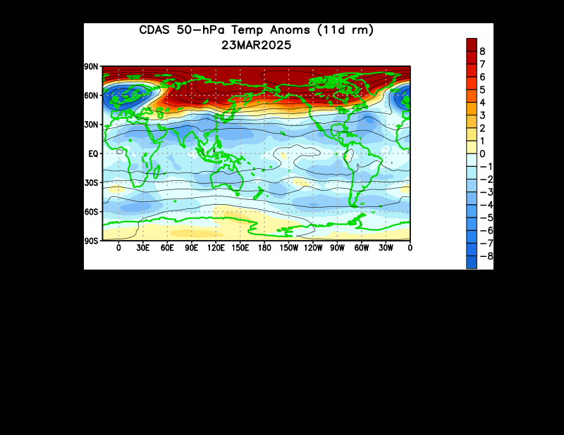
These past few months have exhibited a constant +NAO, +AO, and a relatively neutral PNA. Basically that means the eastern half of the country as a whole will have mild and little to no snow. But I believe a change is in order and forecast models agree.


The AO will crash which is a good sign for cold. The PNA is heading more neutral and exactly what we want to see, but I have little hope for the NAO. Without blocking storms will forced off the Southeast coast or ride up west of the region putting us into the warm side of the system. With little blocking that means coastal storms will probably not be our primary source of snowfall over the next few weeks, instead we need to put our hope into Alberta Clipper systems.

Usually fast movers and lacking moisture these systems usually bring anywhere from a dusting to around six inches, but usually no more. With clippers snow is the primary type of precip and sometimes a little rain on the southern end, so we won't have to worry about it getting to warm for snow. In fact the models show several chances of snowfall in the coming week from these types of storms. I'm not even going to post model maps of these system because they look like small increments of snow. Something like an inch here, half an inch, and maybe up to two inches in spots. Instead I'll give you the link to my model page. Just check out the NAM and GFS SLP maps and pray for a negative NAO, because until then the prospects for a major snowstorm looks bleak at best.


That's it for now. I haven't been blogging a lot this season because I've had nothing to blog about! There were times last year where I would post up to three times a day! But this season it's only been about once a week. Keep your head up and keep reminding yourself, winter only started a few days ago...

Friday, December 16, 2011

Simply An Update

Well now that the past storm is long forgotten it's time to move on. I forecasted the snow totals way too high needless to say. Highest amounts where High Point with 2.5", Budd Lake with 1.0", and 0.5" from multiple locations. I was thinking about 3"-6" for the immediate area but the surface layer held too warm for too long and gave any accumulating snow a difficult time. Places higher in the Poconos received up to 6" and the Catskills 8". In the end elevation was key with that storm, something Jersey really doesn't have much off...

Now let's move on to what we are all waiting for...

SNOW OUTLOOK!

To put this years "winter" season in perspective for everyone let's compare it to last year. It was colder and much snowier right? That's what everyone keeps telling me but as of this date last year we received only 0.75" inches of snow fall. So far this year we are at 10"-18" inches. Last year cold air came earlier and Mountain Creek opened by the second week of December, but this year it will open the third week. That's just one week! So the ski resorts are delayed slightly, I've seen worse.

First off there is a chance for some snow flurries this weekend as a weak clipper system moves to our south. Nothing to get excited for but it's snow. After that another storm rides up the Appalachians by the middle of the week and brings us just plain old rain and temperatures back into the 50's for highs.

Just a few days later, on Christmas eve, the models suggest another storm:

If there are any storms in the future capable of a major dump of snow it will would be this storm. Forecasted a week from today it has the classic high pressure to the north and winds from the north northeast, the tropical moisture, and plenty of cold to tap into. If a storm does form in this type of pattern it will be a complete bomb. And by that I mean rapid pressure drop and heavy snows. For now we need to watch this closely. If all these ingredients can come together just right we have a good shot of a White Christmas.

-------------------------------------------------------------------------------------
***SNOW MAKING UPDATE***

Mountain Creek was able to put out some serious snow with the past cold air outbreak but it just was not enough to open. This weekend forecasts are calling for highs in the upper 30's and low in the mid 20's. Just yesterday they forecasted to be in the 40's and low's in the upper 20's. The reason? The online forecasts are adjusted to climatology and personally that just doesn't work. Saturday for example should only get to 32 for a high and 21 for a low. Sunday's high will only be 29 and the low near 17. This means a solid 48 hour snow making period and means they should have enough snow to open by Friday, and if we are lucky maybe some natural snowfall?

This weekend:

Check back for more updates. May the weather be with you!

Wednesday, December 7, 2011

Here Comes More Snow!

This storm has given me a really big head ache. North West Jersey is right on the boarder line of getting a good solid cover of snow or getting shafted. This was one of the hardest forecasts I ever worked on but I think I have it all figured out. Check out the NAM for 18 hrs out, which is sometime tonight after the evening commute.

Just looking at the model is impossible to tell the precipitation type. Up until this point its rain but let's look at the sounding for the same hour.

Im actually surprised but it shows a snow sounding with no questions asked. It is a fast moving system and hour 24 on the models the back has already pulled out of the area. This leave us with about a 6 hour window of snowfall tonight.

(Hour 24)

Now let's look at the QPF (total liquid precip) that falls as snow.
It has most of north Jersey in the 0.75" - 1.25" range. Now take in consideration a warm ground, a wet surface from rain, and only marginal air temps. The liquid to snow ratios are going to be pretty low meaning a wet heavy snowfall. Elevation will help in this storm but more importantly is your location west. After hours of being a computer nerd this is what my snow map looks like.

Of course a slight shift in the current path of the storm could either give us more in the way of snowfall or leave us with very little. But it does looks as if western areas get the most either way.
------------------------------------------------------------------------------------------
***** SNOWMAKING UPDATE*******************

I want to talk a little about the snow making potential at local ski resorts. It looks like the guns will be on this weekend but unfortunately only at night and morning and only a total of around 18 hours of a wet bulb of 27 or less. Not enough by any means for the resorts to open. After this cold shot its back to above average and in my personal opinion the local resorts won't open until Christmas day or so.

Monday, December 5, 2011

Is Winter Back?

The models are hinting at a potential snowstorm come Thursday. Let's give it till tomorrow and see if the models come into alignment.

Friday, November 25, 2011

Waiting For Winter

While Killington Vermont has 111 acres of skiing open Mountain Creek has yet to even turn on it's powerful snowmaking system. It has nothing to do with the resort itself but the lack of cold air we have had. So far this season we have only had a 20 hour period of potential snowmaking conditions and that was after the major Halloween snowstorm where temps dipped into the low 20's. The fact is it's still fall and winter doesn't technically start for another month yet we are currently 10x to 18x above our average snowfall for the season thus far. If it didn't snow until the middle of January we would still be above average for the season!

It seems like my blog posts increase 95% when an extreme event approaches, or when weather begins to get interesting. Probably lack of motivation but would anyone really want to read a blog about how dry and seasonable it's going to be? The reason I mention this is because I am getting excited, and for good reason.

A pattern that often produces cold and major snowstorm is a -AO, -NAO, and +PNA, especially all at the same time. If you look at the chart below it shows exactly that, and that's why early December will provide snow and cold enough weather to allow for around the clock snowmaking. The only problem is trying to keep the cold air in place across the east once it arrives, which may be difficult.


The lack of any stratospheric warming event indicates a lack of strong blocking, therefore when cold air does arrive it doesn't last long. Essentially the arctic air will hit hard for a few days then continue it's journey out to the Atlantic where it will modify and lose it's arctic characteristics.


The models do suggest some interesting weather as we head into December, and I agree. All we can do now is sit back, wait, and enjoy what "nice" weather we have left. Check back in a few days for updates.

Thursday, November 17, 2011

Thanksgiving? Could it snow?

Once again the european model has caught eye of a potential snowstorm. It's only one model and one run but this is the same model that forecasted the Halloween storm a week prior. Let's see what tomorrow brings.

Saturday, November 5, 2011

Winter Outlook 2011-2012

This winter outlook is much shorter than ones in the past because I already post a blog which I called my pre-winter forecast. That goes more into depth into the main reasons behind my thinking and you can check it out here: Pre Winter Forecast
-------------------------------------------------------------------------------------
This is the first time I have ever done a winter forecast already having a major snowstorm behind us so I will be including that event into my snowfall prediction. Let's start off with the projected winter season temperatures:

The map above does show the heart of the cold this winter over the upper mid west and great lakes region. This will result in some major lake effect snow outbreaks and a storm track that brings the snowiest conditions to the Appalachian Mountains. The early part of the winter willcome with much colder than average temperatures and above average snowfall right up to the holidays. During the heart of winter there may be prolonged periods of ridging over the east which will help to bring the average winter temp up to just below average.

Forecasted precipitation from average:

Unfortunately for Texas the drought will continue through the winter months as the northern tier gets their fair share of precip. The lakes region will end up well above average associated with the lake effect snow events.

I promised a short winter forecast this year so I don't put everyone to sleep so here is my project winter snowfall forecast for the area:

(**Just a note on snowfall. Just one snow event can drastically alter the accuracy of this map and it's not easy to forecast snowfall within a ten inch range. Last years map was bust on eastern sections mainly because of nearly 30" of snow during the post Christmas blizzard)

Wednesday, November 2, 2011

Winter Has Just Begun

Unfortunately I wasn't able to work on my winter forecast due to lack of power. I plan on getting it finish by this weekend if all goes planned. I think I've had enough snow for now but I do want to recap the storm a little and talk about a major pattern shift coming mid month.

Snow totals across the state from the October snow storm:

Basically the higher terrain got hit the hardest with the storm and most of Sussex County for that matter. I picked up 16" at my house, around 18" in West Milford, and even Central Park picked up 2.9". The totals aren't nothing compared to what we see in the winter but since the leaves have yet to drop the situation went from plowing and shoveling to all out destruction. Basically this set records for everywhere. If this had been January then the snow totals would be measured in feet.

This storm made us realized how fragile civilization really is. When the power is out basically your back in the olden days. Food went bad in refrigerators (even in stores), gas stations ran out of gas (if they had power to pump it), roads were impassable (that's an under statement), and for the first time I felt at the mercy of the weather. Some roads are still in bad shape and many residents are still without power. Stores that don't have power are losing a lot of money and employees aren't getting paid to do nothing. I even ran out of money. Without power ATM's and credit machines weren't working, forcing people to drive long distances just to get some cash out of a working machine.

Want a hot meal? Can't cook without power, and neither can Burger King or Ted's Deli. Want milk? Well the trucks can't make deliveries without fuel that was hard to come by and stores can't keep food cold without power. Want that tree off your house? Your local tree cutter isbooked for the next month. Want heat in your house? The stores are all sold out of generators and kerosene heaters. This was the most destructive storm in north Jersey I have ever seen, and may end up being the most costly of all time. We are at the mercy of mother nature and this storm was a harsh reminder of that.
------------------------------------------------------------------------------------------
Let's move on to the long range outlook. First let's take a look a the three teleconnections that affect our region the most:


As seen above the NAO and AO both take a nose dive into negative territory. This can only mean one thing, a pattern change. The NAO going negative will allow for storm to ride up the coast line and the AO will essentially displace the cold air from the pole to lower latitudes. This is will be the first real arctic outbreak of the winter season. The values go negative next week and we will allow for about a weeks lag, so around November 15th place like Mountain Creek and pretty much every resort on the east coast can turn their snowmaking systems on full blast.

One thing we want to look for is a stratospheric warming between 10mb-100mb, but I have yet to see one of any significance. Give it a week and a major event will be occurring over the western Pacific.

By the second half of this month we will be talking about snow again but by that time the leaves would have dropped from the trees so widespread damage is not likely.

Friday, October 28, 2011

Batten Down The Hatches... (Snow Map)

Let's talk snow!? First off I am much more worried about this storm than any others I have personally experienced. And that's because the leaves have not fallen off the trees yet. In fact some urban areas with exotic and invasive tree species still have green! It only takes around 2"-3" of snow to take down a tree with leaves. Now what if you get 8"-14"? And some models even suggest up to 20" in some locals (highest terrain). This is a major problem, and power outages are not just likely but certain. Here aresome tips:

-Take down any outdoor screen houses/umbrellas
-Don't park under tree limbs!
-Keep the space heater ready, if power goes out so does heat!
-If you need to keep food items cold outside works. Unless a bear comes...
-No matter your age, take breaks while shoveling. This snow is often called "cardiac snow".
-Do not walk/stand under stressed trees with foliage
-Above all, don't under estimate the storm just because it's October...

Elevation will still play a major role in this storm, but so does the exact track. I'm going to take the average liquid equivalent of all models and use that to draw my map while keeping terrain into consideration. Let's look atthe QPF maps:

NAM: (1.5"-2.00")

NMM: (2.00"-3.00"+)

GFS: (1.50"-2.50")

JMA: (2.00+)

Now that we have a good idea of precip amounts let's look at the sounding:
Above is a vertical profile of the atmosphere and the red link represent freezing. The long blue line are temp and dew point. When they come close to each other it means the air is saturated, in this case it's not clouds but HEAVY precip. If you look closely the lowest level is above freezing to start the storm. This means areas below 1,000 feet will start off as rain. Above that expect all snow from the beginning. To those of you below 1,000 don't fear, the rain falling will actually cool the surface quickly and change it over to snow. It's better known as evaporational cooling.

Let's progress to the height of the storm:
Now that's what I call a PERFECT snow sounding. No significant upper level inversions, which means no mixing! At this point in time snowfall rates could be near 2"-3" an hour! Highest elevation will be colder than lower ones, which means higher snow ratios and thus deeper snow.

Now that we cleared all that up let's look at the snow map/forecast:

Map considers these circumstances:
Most affected (Morris, Warren, Sussex, western Passaic)
-Average precip total (QPF) for entire area = 2.125"
-Snow ratio of 8:1 to 10:1 by hour 6 of event
-Surface temp tomorrow for areas <500' = 34.1
-Surface temp tomorrow for areas 500'-1,000' = 32.5
-Surface temp tomorrow for areas 1,000'-1,500'= 30.8


-Also expect gusty winds out of NE
-Thunder snow is being forecasted
-White out conditions at times


Be safe and stay classy...


P.S. What do you think of this new format for snow map blogs? Does it help with understanding the event? Comment or send email to millirod@kean.edu

Thursday, October 27, 2011

It's Snow Time!

Well, the chances of it snowing look pretty good for the area. Actually, I would say it's almost certain at this point. The european model was the first to catch onto the system and now most operational models are showing the same scenario. The only question is how much snow will fall?

Let's take a look at the latest GFS:

Essentially all models are showing this now with the exception of the NAM. It will probably catch on by the 18z run time. Basically we just need to know how much liquid precipitation is forecast and translate that into snowfall amounts. The GFS forecasts around an inch liquid for Sussex County, so that would mean around 4"-10" inches of snow! It's a large range because lower elevations *will* get less snow than the higher terrain because the temperature factor.

Take a look this sounding for Sussex County:

Any forecasts you see of rain/snow/mix are completely inaccurate. This storm will bring all snow to the area with no mixing. Nothing even suggests such a thing so I'm not sure what those forecasts are about. Anyhow, the sounding above shows there will be no warm layer inversion so it's either rain or snow. No sleet or freezing rain thank god! High temperatures forecasted by NWS are in the mid and upper 40's! That's wrong. When the precip falls (especially heavy) it will cool the atmosphere and temps will struggle to rise above 32 degrees in the higher terrain and 35 in valleys!

I still need to make a snow map. It will be out tomorrow.

P.S. It looks the rain today may end as a brief period of snow in some spots around 00z!

Tuesday, October 25, 2011

Is It Time For Snow Already?

Let's get this straight. Some computer models suggest a storm moves through Thursday and brings our area mostly rain with a potential change over on the back side for parts of Sussex County. Personally I think the precipitation will end just before the cold air advances, essentially only bringing us a chilly rain event. Now currently there are two models that suggest a second system will ride up the coast and throw nearly an inch of liquid precipitation into cold air (this includes the entire state). Let's take a look at these models:

JMA (Japanese Model):

Okay so the model above shows high winds and nearly 20" inches of snow across New Jersey, which I do not believe. This model always has an issue with predicting total QPF (total precip) but the physics in the model seems to be somewhat trustworthy. The blizzard depicted above is not very likely, but it does help support the idea of some kind of snow event.

ECMWF (European Model):

Above is the snowfall forecast for hour 105 and it's only a three hour increment. The total snowfall predicted by the EURO is 6"-10"! This model has been consistent for the past several runs, something that meteorologists look for when analyzing model output. Also the EURO is known for having better physics in the model than most others.

So far no other models have gone to this idea, instead they just pass off the storm off the Mid-Atlantic coast. As of right now it's too far out for making any kind of calls, but check back tomorrow as I will be posting on the very latest model output and give you my personal opinion.

P.S. Winter Forecast should be out by the weekend

Monday, October 24, 2011

First Snowfall of the Season?

Take a quick look at the sounding. It suggests snow Friday morning for NW Jersey and even into the city! Check back later tomorrow. It's time to start blogging :)

Tuesday, October 4, 2011

Time For Winter Forecast Pondering...

This isn't my official winter forecast just yet. Consider this more of a pre-cast of sorts. Let's start off with the ENSO or El Nino Southern Oscillation. The ENSO phases La Nina/El Nino are based off whether the surface temperatures in the Pacific are colder or warmer than the normal. The Pacific is the worlds largest ocean and changes in surface temperatures can greatly affect the weather here in New Jersey. Let's look at the PDO first since it has a strong correlation with the ENSO phase. A warm phase in the PDO is when the water temps off the west of Canada and Alaska are warmer than normal, thus El Nino's tend to be stronger and occur more often. A cold phase is the exact opposite and allows for more and stonger La Nina's.

As we can see from the chart above we are in a cold phase of the PDO, and that means La Nina's should dominate the Pacific over the next 10-20 years since the PDO works in 30 year intervals typically. This years ENSO phase should be similar to last years La Nina which spells colder weather for us here in Jersey, or at least for the first half of the winter.

I always look at the current solar activity when making a winter forecast. Little is known about how the solar cycles affect the climate, but it doesn't hurt to look at it.

Above is a graph of the last solar cycle that spiked in late 2003. That solar cycle maximum was much weaker than what we saw in the 90's. A typical solar cycle lasts for around 11 years from minimum to minimum but the most recent went for over 13 years, something we haven't seen since the Dalton Minimum in the early 1800's. You may have heard of some solar storms lately but it's just the beginning of solar cycle 24 which is forecast to be much weaker than any other in modern history. Just take a look.


What will be the affects? It's almost impossible to say for sure, but past studies have suggested that low solar activity could throw the planet into a cooling phase. A good paper I suggest is by David Archibald who has been extremely accurate with his predictions over the past several years. Even better than NASA's predictions which originally forecasted a strong solar cycle which would peak in 2012. That's not going to happen, not even close. "Solar cycle 24: Implications for the United States" is the paper by Archibald and can be found on his website: http://www.davidarchibald.info/

A winter can be cold, but that doesn't necessarily make it a good one. There have been plenty of cold winters that lacked precipitation. That brings me to the next items on my list, the NAO or "North Atlantic Oscillation" and the AO or "Arctic Oscillation". Both of these have negative and positive phases, and for New Jersey we like to see them negative together. Over the past two winters we have had some crazy weather events and most of them were a cause of stratospheric warming events at higher latitudes which affected the AO and NAO. I know, you have no idea what I just said. I'll explain.


The animation above shows temperature anomalies in the stratosphere (up high in the atmosphere). Red is a warming event and blue is cooling. If you look closely at warming events in the animation you see how the jet stream buckles where ever they pop up. This is called blocking and allows for some wacky weather. Such as Mountain Creek in NJ getting 28" of snow and Killington VT gets 2" of plain rain during the same event! It happened in February of 2010 and guess why it happened? That's right, a blocking event directly related to a strong stratospheric warming event. For you global warming fanatics, no this is not because of global warming. A warming stratosphere happens when the troposphere (the surface, where we live!) becomes colder than normal. The opposite goes for cooling events in the stratosphere.

Last year these stratospheric warming events continued despite the end of a El Nino and a start of La Nina. A major warming (though not as major as the year before) event happened in mid-December followed by 32" inches of snow in eastern part of New Jersey. January brought more warming events which lead to the snowiest month in history for much of the state. The signs are obvious and need to be looked at with a fine tooth comb. Looking through all the signs, only one thing has changed since last winter. That being the phase of the QBO or "quasi-biennial oscillation". And it's shift points toward a more ominous winter than last.


The QBO is basically winds between 10mb-100mb. These winds shift from easterly to westerly every 20 to 36 months. As of August the winds officially became easterly, just like they were in the winter of 2009-2010. Last winter I only expected average snowfall for the region and we went over by about 10"-15". This is because last winters westerly phase of the QBO should have helped to suppress stratospheric warming events. Therefore winter shouldn't have been as bad as 2009-2010, and for NW Jersey it wasn't! I can't say the same for NE Jersey. We have entered a easterly phase of QBO and it means more and stronger strat warming events.

This was only my pre-cast. My official winter forecast will be out later this month. There is a lot to talk about and I couldn't possibly do it in one blog post without putting everyone to sleep. If you ask me, this coming winter might leave last year in the dust...

Wednesday, September 21, 2011

I'm still here

Okay, I have some good news! After some issues with my blogger account I finally was able to log in today!

I'm currently working on the blog to tidy it up and expect my winter forecast in the next week or two! It's amazing how fast the summer went.

Thursday, March 31, 2011

Snowmap

Sorry it's a late but this was not easy!


The higher elevations currently have moderate to heavy snow right now and it will continue till tomorrow morning. Unfortunately it looks like the storm won't bring as much total precip as originally though so totals in most areas will not be to big of a deal. Still one heck of an April fools joke...

Tuesday, March 29, 2011

Winters Revenge (Part 5)

When I started the winters revenge blogs 11 days ago I knew we were going back into a snowy and cold pattern but nothing like this. Last week NW Jersey added up 6"-15" inches of snow and I still have 3.5" on the ground today! That tells you that it's been very cold for March snow to stick around this long, it's almost April for crying out loud! Now we are going to add more, and possible A LOT more. The tanking of the NAO is to blame.


Let's look at all the models at Fridays storm system.

Euro:

JMA:

GEM:

GFS:

I think I have made my point. A storm is coming up the coast and it's seen on every model except the NAM. Currently I'm waiting for the 00z NAM to come out to see if it has changed to come in line with every other model.

The problem with this storm is that it needs to pass through the "key hole", a track where it doesn't bring us too much rain yet not to far out to sea to bring us little snow. I think this will happen and that means most of NW Jersey will get significant snow accumulations. The higher up you go, the more you will get.

Right away we should look at the precip type, and we will do that using a sounding.

The yellow line is the freezing mark and the blue is the cold air. The long pink lines are the temperature and dew point and both remain below freezing in the entire air column all the way to the surface for all hours of the event except the first few hours of light precip, which may fall as rain. We just determined that this is a mostly SNOW event! Let's figure 10" inches of snow per 1" inch of liquid because the ground did refreeze and it's snow covered still in most areas.

Time to look at total QPF, remember we have 10:1 ratios.

With around an inch of liquid forecasted you do the math...

Check back tomorrow for my preliminary snow map and update on the situation. By then the exact track should be determined and snowfall amounts can be forecasted.

Saturday, March 26, 2011

Winters Revenge (Part 4)

I really cannot believe this pattern we are going into. North west Jersey has gotten 6"-15" of snow this past week and it looks likely that next week will bring even more! This is off the European model for Wednesday:

This looks like it could bring a few inches to the area and there is a possible late week storm threat that could really put down the snow across the whole northeast.

For those of you who want spring soon (me included), it's not coming. There is strong reason to believe that this April might be one of the top 10 coldest since records have been kept. Along with the cold is the constant threat of snowstorms, we aren't out of the water till May. As I look out my window now I have 6.5" inches of snow still on the ground and today's daytime high only reached 31 degrees. The coldest spring day I can remember while the sun was shinning bright!

Keep checking back in, next week could be more interesting than last.

Tuesday, March 22, 2011

Winter's Revenge (Part 3)

Well winter is back, again. The last system brought some "decent" snowfall to the higher elevations with 4.7" in Wantage, 3.8" in Lake Hopatcong, and 2.8" in Randolph. Places in lower elevations received less like Newton with 1.8". Season totals across NW Jersey are around 50" with more toward the eastern sections and we should break 60" on average by the time the snow season is over with.

Let's talk about tomorrow system. First off elevation will be KEY in this storm as the surface temperatures will be too warm to support all snow in places below 500 feet. Other than the surface conditions the upper air looks great to support wintry precipitation. Take a look at this sounding off the 12z NAM:
The yellow shows the freezing line and the blue lines (temperature and dew point) remain below that point except at the surface. This is for Newark and indicates snow and rain making it difficult to accumulate. Heavy bands of precip will help to cool the surface layer for brief periods and allow snow to accumulate in those areas. Now let's look at the sounding for Sussex County:
NOW this is an all snow sounding for the whole event since the temp remains below freezing all the way to the surface.

Since we confirmed snow for the entire event let's check out how much precipitation will fall inliquid form. It looks to be around an inch for the area, which typically equals 10 inches of snow in the winter but it's spring. So figure 5"-8" in the areas that remain at or below freezing.

NWS MAP:

The snow map:

It going to be a decent storm by March standards. Of course if you have any questions or comments you can comment below, email me, or find me on facebook. Have a safe commute tomorrow!

P.S. Next snowstorm is already on the maps for early week: